| |
| Bayville |
| |
| Center Island: |
| LIE exit 41. North to Route 106 and continue north on 106. Cross 25A continuing on 106. Just into Oyster Bay make left onto Lexington Avenue. Lexington to end and turn left onto West Main Street. Go under train trestle and continue on West Shore Street along water then over bridge into Bayville village. At end make right onto Bayville Avenue and go to Center Island Beach on right. |
| |
| Bayville |
| |
| Locust Valley High School (Just for May 17th) |
| LIE exit 41 north to Route 106. Take Rt. 106 all the way to Route 25A. Turn left onto 25A and go about 2 miles. Turn right onto Wolver Hollow Road at bottom of hill (Old Brookville PD on corner). Go approximately 1/3 mile to first stop sign and turn left onto Piping Rock Road. Stay on Piping Rock past Friends Academy on left. Another ¼ mile take left fork, which is Birch Hill Rd. At end turn right onto Horse Hollow Road. High School on right ¼ mile. Girls lacrosse field behind school up hill. |
| |
| Bethpage |
| |
| Bethpage HS Turf Field- 10 Cherry Street, Bethpage |
| Seaford Oyster Bay Expressway (Route 135). Going northbound exit at Plainview Road. Go underneath 135 and stay straight to HS. Going sourthbound exit at Broadway. Go west to fork and bear right on Cherry Street. Go past stadium and field and turn left into parking lot. |
| |
| COLD SPRING HARBOR |
| |
| Cold Spring Harbor High School: |
| Take Long Island Expressway to the Seaford Oyster Bay(Route 135) northbound and take it to the end. Go east on Jericho Turnpike toward Woodbury. Stay on Jericho Turnpike for a little over a mile and at traffic light turn left on to Woodbury Road. North on Woodbury Road a little over a mile. Just before Train Station, which is on the right,turn left at light onto Route 108 (Harbor Road), which is Harbor Road. Take Harbor Road to first intersection and turn right at stop sign on to Lawrence Road. Go up hill and at top turn left into Cold Spring Harbor School. There is a stone/brick sign on the left for the HS at the top of the hill. |
| |
| Farmingdale |
| |
| Saltzman East Memorial Elementary School: |
| Southern State Parkway to exit 32 North, which is Route 110. North on 110 approx. ¼ mile to first traffic light. Turn left at the light on to Main Street. Go approx. ¼ mile and turn right, just before first traffic light, onto Daniel Drive. School at end of Daniel. Go to back parking lot. |
| |
| Farmingdale |
| |
| Allen Park |
| Southern State Parkway to exit 32 North, which is Route 110. Go north on Route 110 about 1/4 mile to first traffic light. Turn left at light on to Main Street. Take Main Street about one and a half miles to fourth traffic light which is just before the train tracks. At fourth light light turn left on to Motor Parkway. Allen Park is on the right about a half mile. |
| |
| FLORAL PARK-Stanforth Field |
| |
| Stanford Field (behind Elmont Public Library) |
| LIE to Cross Island Parkway south bound. Exit at Hempstead Turnpike going east. Go past Belmont Park Racetrack and Stanford field will be on the left side (northside) of Hempstead Turnpike. Field is in back of the Elmont Public Library. Go north on Cross Island from Southern State. |
| |
| Garden City |
| |
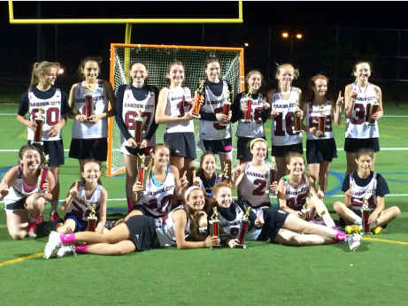
| GARDEN CITY H.S. or ST. PAUL'S RECREATION CENTER |
| Sunday home games all at HS. Saturday Home Games all at St. Paul's. LIE or Southern State Parkway to Meadowbrook Parkway. South from LIE and north from Southern State. Exit at Stewart Avenue. Turn right onto Stewart Avenue. Take Stewart Avenue to end, which is Hilton Avenue. Turn right onto Hilton and at first traffic light turn left onto 9th Street. At end of 9th Street turn left onto Cherry Valley Avenue. At first traffic light turn right back onto Stewart Avenue. At first traffic light turn right onto Rockaway. St Paul's Recreation Center is on left at corner of Stewart and Rockaway. You can actually go past Rockaway and turn into St. Paul's parking lot on right just past school. For High School continue on Rockaway north bound to high school.
From NW Nassau: Take LIE to New Hyde Park Road, exit 34. Go south on New Hyde Park Rd. to Stewart Avenue. Make left on Stewart to St Paul on left (northside). To HS go past St. Paul's and turn left at light onto Rockaway and ta |
| |
| HALF HOLLOW HILLS |
| |
| HALF HOLLOW HILLS EAST HIGH SCHOOL |
| LIE to exit 51 North. North on Deer Park Avenue to Vanderbilt Parkway. Turn left going westbound on Vanderbilt to school. Make the last left into the school. Fields in back. Turf field at bottom of driveway. |
| |
| HARBORFIELDS |
| |
| HARBORFIELDS HIGH SCHOOL |
| Harborfields High School, Taylor Ave, Greenlawn, NY 11740
L.I.E. to Exit 51. North on Deer Park Ave. Go under Northern State Underpass, BEAR LEFT at Firehouse just passed Northern State, Deer Park Ave Becomes Park Ave/CR-35. Cross over Jericho Tnpk, At the First Light past Jericho Tnpk, MAKE A RIGHT onto Broadway/Greenlawn Rd. Go 2 Miles and MAKE A RIGHT onto Pulaski Rd. School is .2 miles on LEFT (Corner of Pulaski and Taylor Ave).
|
| |
| HICKSVILLE |
| |
| Walker Park |
| LIE 41S and take Hicksville Road (Route 107)south. At third traffic light make a left on to Bethpage Road. Proceed to second traffic light on Bethpage Road and make a left on to Andrews Road. Field on right.
|
| |
| Huntington |
| |
| Huntington High School |
| Long Island Expressway to exit 49. North on Route 110 to Jericho Turnpike. Turn left on to Jericho Turnpike and go to Oakwood Road (Golden Diner is on the corner). Turn right at traffic light on to Oakwood Road. Take Oakwood Road approximately 2 miles to traffic light at McKay Road. Turn tight on to McKay Road to high school. |
| |
| Levittown |
| |
| Levittown Memorial High School |
| Southern State Parkway to exit 28 north, which is Wantagh Avenue. Go north on Wantagh Avenue 1/4 mile to first traffic light. Turn left on to Jerusalem. Take Jerusalem about 1/2 mile to second traffic light. Turn right at light on to Gardiners Avenue. Take Gardiners about 2 miles. Go past Abbey Lane Elementary school on right and turn right at traffic light on to Reed. At quick end, turn right on to Abbey Lane. School on right. |
| |
| Long Beach |
| |
| Field- Long Beach Middle School |
| Directions: Meadowbrook South past Sunrise Highway to exit 10, Loop Parkway, to Lido Blvd. Right onto Lido Blvd. Middle School is 1 ½ miles west on Lido Blvd adjacent to Lido Golf Course. Make right into driveway. Fields behind school.
|
| |
| Manhasset |
| |
| Field- Manhasset H.S. |
| Directions: LIE, from the west exit 35 (Shelter Rock Road) and from the east exit 36 (Searingtown Road). Follow Service Road to Shelter Rock Road. Go north on Shelter Rock Road approximately 2 miles to end. Turn left on Northern Blvd. (25A). At second traffic light turn right onto Plandome Road. At first traffic light (Police Booth on corner) turn left onto Memorial Place. School at end. Fields behind school.
|
| |
| Massapequa |
| |
| Field Of Dreams |
| Directions: LIE or Southern State Parkway to Seaford Oyster Bay Expressway south. Exit onto Sunrise Highway going east towards Massapequa. Take Sunrise Highway approximately 3 ½ miles. Just before train trestle crossing Sunrise Highway, near Sunrise Mall, bear right onto Old Sunrise Highway. Field Of Dreams on Old Sunrise Highway on left side about ¼ mile just adjacent to, and south, of train tracks.
|
| |
| Massapequa |
| |
| Burns Park (2008 Field) |
| Southern State to Seaford Oyster Bay (Rt. 135) and go south on 135. Take Rt. 135 all the way to end, Merrick Road. Go east on Merrick Road to Burns Park on right. Go past Massapequa HS before Burns Park. |
| |
| Mineola |
| |
| Mineola High School |
| 10 Armstrong Road, Garden City Park, NY 11040.
Northern State Parkway to Glen Cove Road. Exit at Jericho Turnpike West. Go west about two miles. Make a left onto Herricks Road going south and then make the next right onto Washington Avenue. |
| |
| North Shore |
| |
| Field- Glenwood Landing School |
| Directions: LIE to exit 39 North and take Glen Cove Road north. Cross over 25A. Three traffic lights past 25A turn left. Go under train trestle to stop sign and turn right onto Glen Cove Avenue. At first traffic light turn left onto Scudders Lane to bottom of hill. Make right onto Cody Avenue. School on right.
|
| |
| Northport |
| |
| Field- Northport High School |
| Directions: Northern State Parkway to exit 42 North (Deer Park Avenue/Rt.231) Under overpass bear right (fire department on right). Right onto Jericho Turnpike and immediately get over into left hand lane. Turn left, at first traffic light, onto Elwood Road (Blockbuster on corner). Go approximately 2 miles on Elwood. Cross over railroad tracks and high school is on the left.
|
| |
| Northport |
| |
| Pulaski Road School (2008 Field) |
| Northern State Parkway to exit 42N (Deer Park Avenue/231). Under overpass bear right (fire department). Right onto Jericho Turnpike(immediately get into the left hand lane). Turn left at first light onto Elwood Road (Blockbuster on corner). Go approximately 1.5 miles. Turn right onto Pulaski Road (field is on corner).Make 2 first lefts off Pulaski entering school from the rear. |
| |
| Plainedge |
| |
| Plainedge High School |
| Southern State Pkwy to Exit 29(Hicksville Road/Route 107). Go south 3 blocks, at traffic light(Wyngate Drive) make a left and continue to end. Games will be played on the football field which is behind the baseball field in the back of the school.
|
| |
| Plainview |
| |
| Field- Plainview - Old Bethpage Middle School |
| Directions: Seaford Oyster Bay Expressway to Old Country Road exit. Head east on Old Country Road to Central Park Road (Police booth on corner) and turn left heading north. Continue to blinking traffic light and turn left. Field on left.
|
| |
| Rockville Centre |
| |
| Field- Skelos Field 1 (Peninsular Blvd) |
| Directions: Southern State Parkway to exit 19 south. South on Peninsular Blvd. ¼ mile to field on right.
|
| |
| Seaford |
| |
| Field- Seaford High School |
| Directions: LIE to Seaford Oyster Bay Expressway, Route 135. South on 135 to Jerusalem Avenue (Rt. 105), which is just south of Southern State Parkway. Make an immediate left off of exit ramp and then make a left at traffic light at Jerusalem. Go under Rt.135 bridge and make first right on to Seaman Neck Road. High School on left about ¼ mile.
|
| |
| Wantagh |
| |
| Field- Forrest Lake Elementary School |
| Directions: Take Wantagh Parkway south to Sunrise Highway. Exit on to Sunrise Highway going west toward Bellmore. Make immediate right at first traffic light on to Old Mill Road. Go north on Old Mill about a mile to end. School on right. Make right at end of Old Mill on to Beltagh Avenue. Fields on right.
|
| |